The 15th issue of the Planner’s Portfolio looks at several planning topics through a health lens.
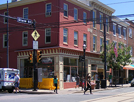
Healthy communities are places where the healthy choice is the easy choice for everyone who lives, works, or visits. This means more than just the absence of illness and rather focuses on creating healthy lifestyles. The design of a community directly affects the ability of people to live a healthy lifestyle.
This portfolio provides a short handout which focuses on key elements to a healthy community such as equity, physical activity, social connectivity, and healthy food access. It also includes an easy to use healthy community checklist that can help assess whether a policy, plan, or project will improve the health of residents in your community.
A healthy community can, for example, create inviting places for residents, workers, and visitors to exercise or play and encourage people to walk or bicycle to destinations to increase physical activity. Community trails and complete streets, which provide safe spaces for all driving, bicycling, walking, and public transit, make it easier and safer for people to incorporate physical activity into their everyday life.
The County works closely with Delaware Valley Regional Planning Commission (DVRPC) and PennDOT to identify state roads that are scheduled for resurfacing and discuss potential changes to the road configuration. This identification provides opportunities for striping improvements, road diets, lane re-allocations, bike lanes and other components of complete streets. You can find more information about the Complete Streets Resurfacing Program here.
For more information, check out the Healthy Communities issue or the entire Planner’s Portfolio series.


The 16th issue in the Planner’s Portfolio series explores the concept of Aging in Place, or helping people remain in their communities as they age.
Aging-in-Place is the idea that people should be able to remain in their existing homes or communities even as they age and their needs change. According to census data, the population of people 65 and older in Pennsylvania has grown at a much faster rate than the general population in the past 5 years, and is expected to keep growing. This means significant portions of the population will have changing needs and demands in the years ahead. There are issues that municipalities should be aware of and steps they can take to ensure that their older residents feel safe, welcome, and engaged.
This Planner’s Portfolio looks at issues related to aging-in-place and provides recommendations for creating “age-friendly” communities. It focuses on the topics of housing, mobility, public spaces and parks, and social opportunities and civic engagement.
For example, housing is particularly important to aging populations. Age-friendly communities offer a variety of affordable, safe, and accessible housing options. Zoning can facilitate aging-in-place by allowing for a variety of housing types from large managed care facilities to accessory dwelling units in rear yards. New construction can be encouraged to utilize the “Universal Design” concept, which encourages design usable by everyone, regardless of age or ability.
For more information, check out the Aging In Place issue or the entire Planner’s Portfolio series.
The 17th issue in the Planner’s Portfolio series explores Form-Based Codes, an alternative to standard zoning that is gaining popularity all around the country.
A Form-Based Code is an alternative to a regular zoning code that allows municipalities to manage the look and feel of their community. While traditional zoning focuses on use (with little to no emphasis on appearance), form-based code focuses on aesthetics, and uses fall in line in order to maintain or encourage visually appealing areas. Communities looking for a way to preserve open space and enhance a specific style of built structures in their town should consider a form-based code overhaul to their zoning code, or a combination of form-based and traditional zoning techniques.
The first step towards implementing form-based code is identifying how you want your township or city to look; the code is then built out around these design choices in order to guide future development, and maintain or encourage visually appealing areas.
For more information, check out the Form-Based Code issue or the entire Planner’s Portfolio series.
The 18th issue in the Planner’s Portfolio series explores Automated Vehicles, a future technology that could have big implications.
Automated Vehicles have been a growing trend in the transportation industry, with major companies and universities researching and testing vehicles. Automated vehicles rely on sensors to assist with driving functions. These technologies have been developing over time and in recent years there have been advances that would allow automated vehicles to pilot themselves. As automated vehicle technologies continue to advance, they are expected to shape our transportation landscape.
This Planner’s Portfolio will explore the types of automated vehicles, current testing initiatives, and detail the potential benefits of Automated Vehicle Technologies.
For more information, check out the Automated Vehicles or the entire Planner’s Portfolio series.
The Delaware County Planning Department offers educational resources to assist in problem-solving and traversing complex planning topics.
The Department provides educational information to municipalities and local residents throughout the year to help introduce new planning techniques, explain complex concepts, and spread the word about the planning discipline. These pages offer more information on planning related topics, educational workshops, and other guides and models to help build a more engaged and informed community.
I’M INTERESTED IN…
- Learning about planning-related topics through a Planner's Portfolio
- Enrolling in a Pennsylvania Municipal Planning Education Institute course
- Looking at Model Ordinance Guides
- Exploring other Regional Partners
- Finding Planning Publications
- Examining Demographic Data
Questions about Planning Education? Contact the Planning Department at 610-891-5200 or Planning_Department@co.delaware.pa.us.
Providing security and weather protection for your residents and employees who ride the bus doesn’t mean you have to accept the advertising companies’ shelters.
Bus stops serve as a gateway into the transit network. Shelters with amenities can be dignified and attractive features that municipalities can take great pride in. Findings from a 2017 University of Utah study found that added shelters and amenities increased ridership while reducing paratransit demand, creating a more efficient transit network.
Amenities should go beyond a shelter and a bench. A transit map, signage, and even real-time arrival information can be invaluable resources for all riders, particularly those who are new to the system. Trash receptacles are useful for passengers, along with lighting to increase safety and visibility of riders. Shelters should be designed for visibility, so that riders can see the bus, and bus operators can see riders.
EXAMPLES OF SHELTERS FROM LOCAL MUNICIPALITIES AND ELSEWHERE
Most bus passenger shelters at bus stops are installed by advertising companies who accrue revenue from the advertising that the shelter holds. However, their shelters have minimal amenities for bus riders – perhaps two seats in a small shelter. Some municipalities and companies have installed more accommodating shelters that are also more attractive. One Delaware County municipality has designed shelters that have been placed at several locations. Here is Concord Township’s short presentation on their shelters:https://delcodev.ntc-us.com/sites/default/files/2025-02/WCPcsBusSheltersConcord.pdf
Shelters can also serve as connection points to other modes of transportation. Minneapolis, Minnesota has created “mobility hubs”, which are connected to bus stops and host bike share, scooters, and/or bicycle parking. Shelters can serve as connection points to many different modes of transportation and can host solutions to the “last mile” transportation problem.
BUS STOP DESIGN GUIDELINES
Municipalities, employers and developers thinking about providing shelters should review the Delaware Valley Regional Planning Commission’s SEPTA Bus Stop Design Guidelines (2019): https://delcodev.ntc-us.com/sites/default/files/2025-02/SEPTA-Bus-Stop-Design-Guidelines-2019.pdf. This report provides municipalities, local developers, and other local partners a consistent set of guidelines for designing surface transit stops.
Questions about Attractive and Functional Bus Stop Shelters? Contact the Planning Department at 610-891-5200 or Planning_Department@co.delaware.pa.us.
Delaware County Planning can perform various assessments to better plan for current and future public transit ridership throughout the County.
In order to fully evaluate and plan for improved public transit service, analysis is needed to understand existing conditions, how transit services are being used, and determining where the future demand within a given service area or along a service route may be. This analysis can include inventorying transit-supportive infrastructure to interpreting travel patterns for passengers utilizing a particular service.
Questions about Transit Service Assessments? Contact the Planning Department at 610-891-5200 or Planning_Department@co.delaware.pa.us.
Conduct a Transit Needs Assessment
Transit Needs Assessments consist of inventorying transit infrastructure from bus stops to fixed rail facilities. Needs Assessments will evaluate current levels of transit service, identify existing and missing passenger amenities, evaluate parking demand, and make recommendations addressing these findings to better serve the transit demand at a particular stop(s).
Conduct a Travel Survey
A travel survey is an inexpensive tool which helps inform planners on how passengers are utilizing the transit system and generally what their travel patterns and behavior are. Surveys are essential for better understanding individual travel behavior that current ridership information cannot interpret. Surveys are best utilized on a per station basis for light and regional rail service and best utilized along an entire bus route for obtaining information on a particular bus service. The surveys aim to collect demographic information and to determine where a person is travelling to and for what purpose. Additionally for light and regional rail services, a drivershed analysis can be conducted to determine geographically from where most of the passengers who utilize and park at a particular station may be originating.
DVRPC and the Planning Department completed a study to enhance pedestrian safety in the vicinity of the Morton regional rail station with recommendations for improvements and funding.
The Delaware Valley Regional Planning Commission, with assistance from the Planning Department, completed the report Safe Routes to Transit (SRTT): Morton SEPTA Regional Rail Station in 2021. This study was undertaken to develop planning-level designs for improving and expanding walking and bicycling routes to the Morton train station. The design recommendations will be used to support applications for various funding sources. The SRTT program was created to provide technical assistance to municipalities and counties that want to improve pedestrian or bicycle access to rail stations, with an emphasis on implementation. The efforts of this project are intended to culminate in a safer Morton station area. Better facilities that improve safe access to rail stations via walking and bicycling can be relatively easy to implement, promote sustainability and healthy lifestyles, and increase transit ridership without the need to increase parking spaces.
Read the report here.
View the Planning Department’s story map here.
Questions about the Morton Safe Routes to Transit study? Would like to explore how the Planning Department could assist your municipality to improve access to a station? Contact the Planning Department, at 610-891-5200 or Planning_Department@co.delaware.pa.us.
Delaware County Planning can help municipalities develop master plans to better plan for transit-oriented development around transit stations.
Transit Master Plans establish short and long term strategies that aim to guide and strengthen development around public transit facilities, whether those facilities are bus, fixed rail, or a transit center. These plans will provide a strategic vision for a given station area by addressing its current transit service and anticipating its future transit needs.
Questions about Transit Master Plans? Contact the Planning Department at 610-891-5200 or Planning_Department@co.delaware.pa.us.
Develop a Transit Master Plan
Best suited for fixed rail facilities and transit centers, Transit Master Plans would build upon Transit Needs Assessments and further investigate elements necessary for successful transit-oriented development (TOD). Transit Master Plans will:
examine current land use and zoning regulations;
identify parcels with redevelopment potential;
address deficiencies in bicycle, pedestrian, and vehicular station access;
identify parking capacity issues (if applicable); and
recommend enhanced service levels (if applicable).
These factors, in addition to the Transit Needs Assessment, would establish a future vision with implementable short and long-term projects that aim to better integrate transit facilities into their surrounding neighborhoods, enhance customer experiences for captive and future passengers, improve current transit service levels, and help spur economic development.
Funding Assistance
Regional and state funding sources may be available to support your request for developing a Transit Master Plan. For currently available funding assistance programs, see the Funding page.
Delaware County Planning provides technical assistance regarding floodplains and local compliance with regulatory floodplain requirements.
Flooding is an issue that affects all of Delaware County’s municipalities. Planning Department staff often act as a conduit for State and Federal regulatory directives by assisting in dispensing information and/or coordinating meetings. Staff regularly receive inquiries to view the Federal Emergency Management Agency (FEMA) floodplain maps. These maps can be viewed at the DCPD office, but are also available through FEMA’s Map Service Center. FEMA’s online mapping tool allows a user to access FEMA floodplain maps by entering the street address for the desired location.
FLOOD RESILIENCY WORKSHOP
The Delaware County Planning Department conducted a Flood Resiliency Workshop on August 21, 2018, featuring guest speakers from the Delaware County Conservation District, Delaware Valley Regional Planning Commission, and the Federal Emergency Management Agency. Presentation materials and handouts can be found here.
Questions about Floodplain Management? Contact the Planning Department at 610-891-5200 or Planning_Department@co.delaware.pa.us.